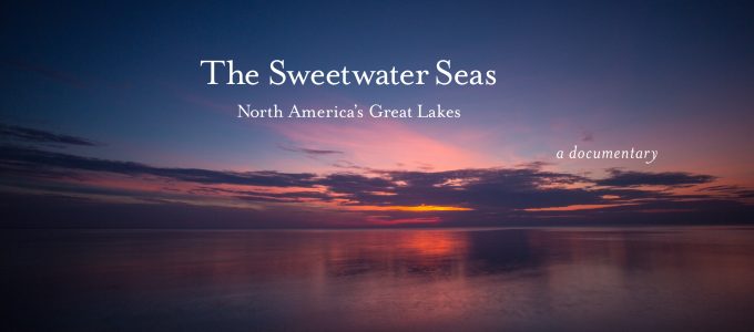
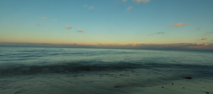
Category: Quiet Light Publishing

Lake Mead National Recreation Area

Images of Lake Mead and Hoover Dam, 2015

It is said the great wars of this century will be fought over water.

The first week of April I was out in Nevada and shot images around Lake Mead which show not only the scarcity of the water with Lake Mead being at its lowest level since Hoover Dam was built in the 1930’s. The lake level has dropped almost 100’ as of 2015, a vast amount of water for a lake which is when full 110 miles long. Harbors have been moved ¼ to almost a mile from where the shorelines were and some harbors just plain closed.

Images of Lake Mead and Hoover Dam, 2015

You can tell how far down it is by seeing the white “bath tub ring” as it is called around the edge of the entire lake. Turning the camera the other way you can also see why this is a National Recreation Area. Its landscape is both arid and beautiful. And gives you a feeling for what we covered over in the landscape by building Hoover Dam and covering over these valleys to create Lake Mead. This lake supplies not only power from the generators in the dam but controls water flow to Nevada, Arizona, California and Mexico via the release of the water down the Colorado River.

Images of Lake Mead and Hoover Dam, 2015

I covered this area as part of The Sweetwater Seas, a documentary on the health and beauty of all five of the Great Lakes. Currently there is an international treaty which protects the lakes from losing water to the west via pipelines. The west is facing the worst water shortage in history.

To see more of the images you can use this link: Lake Mead

Richard

#waterwars

#thesweetwaterseas

#richardmack

#lakemead


2015 Quiet Light Workshops

Pictured Rocks National Lakeshore, Lake Superior

I am pleased to announce the Quiet Light Workshop schedule for 2015 with three workshops I will be leading, two in Great Smoky Mountains National Park and one in Pictured Rocks National Lakeshore along Lake Superior!

Quiet Light Workshops offer Photography Workshops focused on nature & landscapes, travel and trips to some of the best places in the world. Geared to the amateur and advanced amateur photographer looking for the chance to learn from experts in the field. Our photo workshops are designed to take you to some of the best landscapes in the world. During each workshop you will have ample time both in the field and in the classroom to hone your skills with your camera and in the digital world of photography today. Learn tips on Photoshop and converting your images into great looking prints, workflow management, color balances and color calibration to get consistent results in your work.

These are hands-on, in the field workshops with Richard. You will be in surroundings that get your creative juices flowing and will serve as a wonderful photographic classroom. At the end of the day, images will be reviewed and discussed as a group. Techniques will be shared and Richard will work with each of you to improve upon what you’ve shot. The take-away from this workshop will be a better knowledge of how to make your equipment work to the best of its ability, a new understanding of composition, lighting, filters, etc. and a plethora of tips to make your images get the “wow” response.

Do you have a place you’d like to see one of our workshops in? Let us know!

Workshop Schedule

Great Smoky Mountains National Park
Spring Wildflowers
April 23-26, 2015

Pictured Rocks National Lakeshore
Michigan
September 10-13, 2015

Great Smoky Mountains National Park
Fall Colors
October 22-25, 2015

For information about each of these workshops just click on the links. Each workshop is limited to twelve members so sign up fast! check out more at Quiet Light Workshops!

Look forward to seeing you!

Richard

Winter in Great Smoky Mountians National Park on the borders of Tennessee and North Carolina.


Make the Holiday’s Happy!

Need to get some late shopping done? Well how about ordering a signed copy of one of my books – great gifts! You can choose from my first book The Lewis & Clark Trail American Landscapes which chronicles the journey of the Corps of Discovery like you were with them. The images were done at the same time of year the expedition past by these places and words for the journals of Merriweather Lewis and William Clark alongside many of the images describing what you are seeing. There is also a Limited Edition version of the book which includes three fine art prints!


http://shop.quietlightpublishing.com/the-lewis-clark-american-landscapes/

L&C Book Shadow

You can also purchase my second book Great Smoky Mountains National Park: Thirty Years of American Landscapes which looks at parts of our most visited National Park from a perspective those in the park have said is the best they have seen. http://shop.quietlightpublishing.com/great-smoky-mountains-national-park-thirty-years-of-american-landscapes-by-richard-mack/

GSMNP Book Shadow

You can get autographed copies using the link to Quiet Light Publishing’s online shop. You can also purchase both books together at a specially priced savings. Prints, Note Cards and Folio’s of small fine art prints are also available!

GSMNP_Folio_color

Quiet Light Publishing online shop: http://shop.quietlightpublishing.com/

Happy Holiday’s!

Richard


Changes in the Great Lakes Water Levels

Lighthouse Beach Moonrise, Lake Michigan
November 2012

Over the last few years if you live along Lake Michigan or Lake Huron you’ve probably noticed a big swing in the water levels and therefore the size of the beaches. Why both of these lakes? They are the same body of water only separated by the Mackinaw Straights. And while the other lakes have also been higher than they have been since 1998 they are at different elevations from Lake Michigan and Huron.

Here is a graphic view of the changes in Lake Michigan & Huron’s water level as see at Lighthouse Beach in Evanston, Illinois. These lakes have reached their highest levels since 1998 but are still 3” lower than the average in August. In the past year and a half the lakes have gone from their low level in January 2013 to the high level in August. These images show a pretty good range in the levels using the old pier as the visual barometer.

October 2014
October 2014

As I have shot at this pier since 2003 as part of my personal work and more often as part of the Great Lakes Project The Sweetwater Seas, I have been interested in the ebb and flow of the water levels and the amount of beach I could see. As you can see there was a difference from the low in November 2012 and May 2013 (around the lowest period) where the sand stretched out about 20 feet more. The images also show you the way the water covers or doesn’t cover the old piers pilings as well. In nature nothing stays the same for very long.

Why has there been so much fluctuation? Because over the past 18 months we had a winter where close to 95% of all the surfaces on the Great Lakes were frozen over. Therefore the evaporation could not take place over the winter. And as we all know, this summer has been cooler and wetter than average. Making for a net gain in the amount of water in the Great Lakes Watershed.

Lake Michigan Water Levels

Enjoy,

Richard

The statistics came from the Great Lakes Environmental Research Laboratory in Ann Arbor, Michigan.

All Images ©2014 Richard Mack.